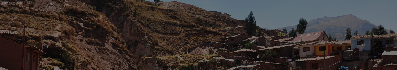
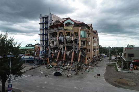
On October 29th, an earthquake of magnitude 6.6 shook the island of Mindanao in the southern Philippines. Two weeks before, in this same area a quake of magnitude 6.4 left several wounded and fatalities.
The epicenter of the earthquake
Considered as an earthquake of "destructive intensity", its epicenter was located near the city of Tulunan; the same place that generated the October 16th tremor, according to Phivolcs (Institute of Volcanology and Seismology of the Philippines).
Phivolcs located the earthquake 60 kilometers from Davao with a hypocenter of 7 km deep, although according to the USGS, the depth of the hypocenter was 15.3 km.
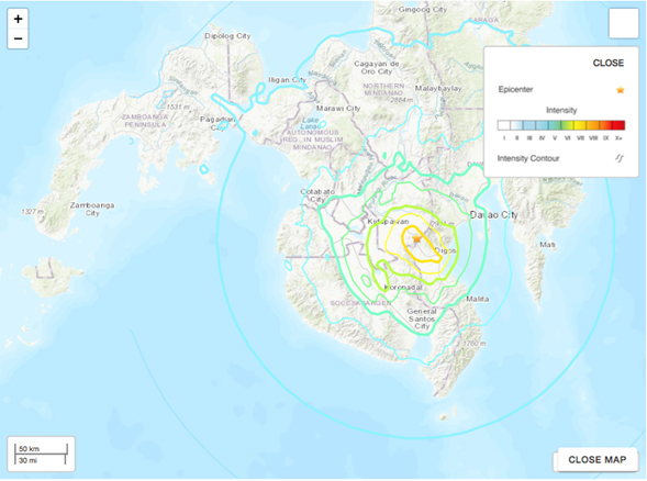
The European macro-seismic scale (EMS) indicates to what degree an earthquake affects a specific place. In the case of the earthquake presented on October 29th in the Philippines, the following macro-seismic intensity map was produced.
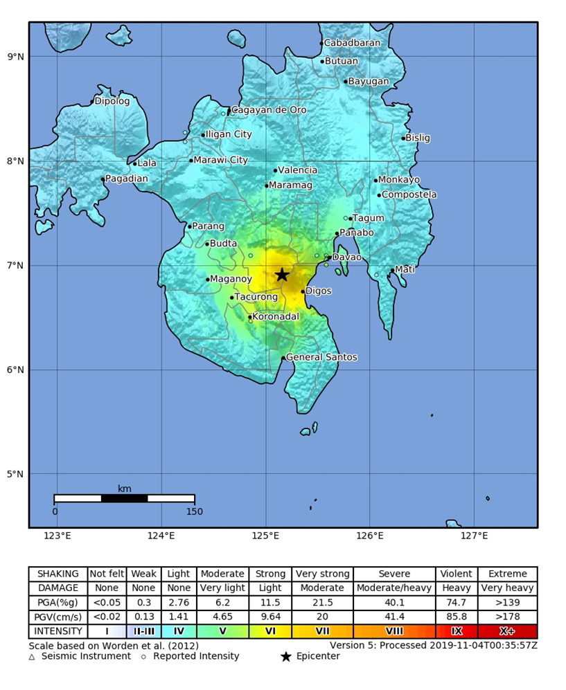
The map indicates that the cities of Budta, Maganoy, Tacurong, Koronadal, Digos and Davao were the most affected, located between 100 and 150 km from the epicenter of the earthquake. Moreover, the earthquake came to be felt at distances farther than 200 km from the epicenter, in cities like Panabo, Tagum, Maramag and Valencia.
The Philippines are located in an area known as the Pacific fire ring, which explains the large number of earthquakes that affect the region.
Pacific Fire Ring
The Pacific fire ring refers to an area that surrounds the Pacific Ocean and has a high seismic and volcanic activity. It extends for approximately 40,000 km and goes from New Zealand to the coast of South America, passing through East Asia and Alaska. The Belt marks the edges of the Pacific plate and smaller tectonic plates that make up the earth's crust.
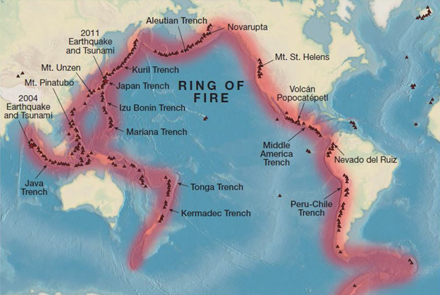
The plates move on top of the mantle and tend to collide with each other, apart from separating from each other or sinking under each other. All of the above movements produce particularly active seismic zones.
There are different active areas among which are:
- Convergent limits: Normally in subduction zones.
- Divergent limits: The plates separate from one another.
- Transformation limits: The edges of the plates slide parallel or horizontally to each other.
- Hotspots: Areas where the mantle has a higher temperature than other areas, and hot magma can rise to the surface and produce active volcanoes.
References
https://www.geoenciclopedia.com/cinturon-de-fuego-del-pacifico/
https://digitallylearn.com/what-is-the-pacific-ring-of-fire-and-map-upsc-ias/
https://www.nytimes.com/2019/10/30/world/asia/philippines-earthquake-davao-mindanao.html
https://earthquake.usgs.gov/earthquakes/eventpage/us700061e9/executive
https://earthquake.usgs.gov/earthquakes/eventpage/us70005ulm/executive
https://www.mirror.co.uk/science/what-pacific-ring-fire-facts-12342864
▪ ▪ ▪
Related content:
Why there's a ring of natural disasters around the PacificThe belt of volcanic activity is called the Ring of Fire. |